OECTA Hamilton–Wentworth  ·  Land Acknowledgement

The Land We
Gather On

A land acknowledgement is more than words. These are the nations whose territory this is, the treaties this land is held under, and the history behind them — offered in the spirit of Truth and Reconciliation.

Land Acknowledgement

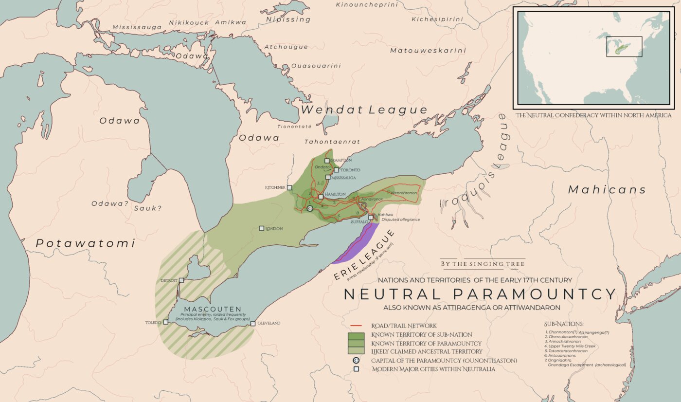
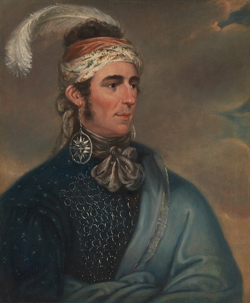
We wish to acknowledge this land on which we gather. For thousands of years it has been the traditional territory of the Erie, Neutral, Huron-Wendat, Haudenosaunee and Mississaugas.

This land is covered by the Dish With One Spoon Wampum Belt Covenant, which was an agreement between the Haudenosaunee and Anishinaabek to share and care for the resources around the Great Lakes.

We further acknowledge that this land is covered by the Between the Lakes Purchase, 1792, between the Crown and the Mississaugas of the Credit First Nation. We recognize and deeply appreciate the historic connections of Indigenous peoples and their contributions in shaping and strengthening our province and our country.

As settlers we are committed to the promise of Truth and Reconciliation, partnership, and enhanced understanding.

Indigenous History — the land beneath Hamilton

Long before there was a Hamilton, people lived, farmed and gathered at the head of this lake — and they are here still. June is National Indigenous History Month, with National Indigenous Peoples Day on June 21: a fitting moment to walk the long story of this place. The map and timeline below trace it from the first peoples to today — honestly — including the treaties this land is held under, and the promises that were broken. The land acknowledgement at the top of this guide names these nations and treaties; what follows is the history behind those words.

The land at a glance. Use the toggles to turn layers on and off — the traditional territories of the nations of this region (Neutral/Attawandaron, Haudenosaunee, Mississaugas, Erie and Huron-Wendat), the treaties this land is held under (Haldimand 1784; Between the Lakes 1792), and key places and nations today. Click any shape to learn more. Territory outlines are approximate and overlapping — not legal or official boundaries; we defer to the nations themselves. Sources: basemap © OpenStreetMap contributors; the traditional-territory & treaty outlines are from Native Land Digital (CC0). For a deeper, Indigenous‑led view, explore Native‑Land.ca ↗.
11,000
years ago
Since time immemorial

After the ice

As the last glaciers drew back, people followed the new forests and shorelines north into this region. The head of the lake — its marshes, creeks and escarpment — has been home to human communities ever since, for more than ten thousand years.

Learn more →
c. AD
500–1000
The marsh and lookout at Cootes Paradise, Hamilton, at the head of Lake Ontario
Cootes Paradise, at the head of the lakeLucas T Photography · CC BY 4.0 · Wikimedia ↗
Princess Point, Cootes Paradise

The first farmers here

On the marsh shore at Cootes Paradise — the place archaeologists call Princess Point — Indigenous communities grew some of the earliest corn in what is now southern Ontario. It marks the turn toward settled farming life, right here at the head of the lake.

Learn more →
1500s–
1650
Map of the Neutral Confederacy's territory around 1600, with Hamilton at its centre
The Neutral homeland, c. 1600 (Hamilton near centre)Map: The Hsinging Tree · CC BY-SA 4.0 · Wikimedia ↗
People of the deer

The Neutral, or Chonnonton

When Europeans first came, the head of the lake was the heart of the Neutral Confederacy — Attawandaron, who called themselves Chonnonton, “the people of the deer.” They farmed and traded from dozens of villages across this region, and by the 1620s were led by a single head chief, Souharissen; French traders named them “Neutral” for the peace they kept between the Wendat and the Haudenosaunee.

Learn more →
c. 1650
A turning point

The fur-trade wars

In the upheaval of the seventeenth-century fur-trade wars, the Neutral were dispersed — many absorbed into the nations of the Haudenosaunee Confederacy. They did not vanish; their descendants live within those nations today.

Learn more →
c. 1700
Anishinaabe

The Mississaugas arrive

Through the early 1700s the Mississaugas — an Anishinaabe people — moved south to the north shore of Lake Ontario, including Burlington Bay and the Hamilton area. They were the nation holding this land when the first settlers came.

Learn more →
1701
A purple and white wampum belt in a museum case
A wampum treaty belt (representative — not the Dish With One Spoon belt itself)Photo: Daderot · Peabody Museum · CC0 ↗
One dish, one spoon

The Dish With One Spoon

The Haudenosaunee and the Anishinaabe marked their shared use of these lands with the Dish With One Spoon — a wampum covenant to share the territory and its gifts, and to take only what you need so there is always enough. This land is still spoken of as Dish With One Spoon territory.

Learn more →
1784
Portrait of Thayendanegea (Joseph Brant), Mohawk war chief, by Gilbert Stuart
Thayendanegea (Joseph Brant), by Gilbert Stuart, 1786Gilbert Stuart, 1786 · public domain · Wikimedia ↗
The Grand River granted

The Haldimand Proclamation

After the American Revolution the Crown granted the Six Nations roughly 950,000 acres — six miles on each side of the Grand River, from its mouth to its source — for their loyalty as British allies. Led in part by Mohawk war chief Joseph Brant (Thayendanegea), many of the Six Nations resettled along the Grand, a short drive from Hamilton.

Learn more →
1792
The treaty that covers Hamilton

The Between the Lakes Treaty

Present-day Hamilton is covered by the Between the Lakes Treaty (Treaty No. 3), made with the Mississaugas of the Credit and named in the City's land acknowledgement. The Mississaugas understood it as continuing to share the land; the Crown recorded it as a permanent surrender — a gap in understanding that shadowed much of what followed. Two neighbouring surrenders — the Brant Tract (1797, at Burlington) and the Head of the Lake purchase (1806) — complete the treaties over the head of the lake.

Learn more →
1813
Portrait of Major John Norton (Teyoninhokarawen), Mohawk chief, by Mather Brown
Major John Norton (Teyoninhokarawen), by Mather Brown, c. 1805Mather Brown · public domain · Wikimedia ↗
The War of 1812

Defending the head of the lake

When war came, Haudenosaunee warriors led by John Norton (Teyoninhokarawen) fought on their own terms. Norton’s scouts went ahead of the night attack at the Battle of Stoney Creek (1813), and his fighters covered the British retreat to Burlington Heights — today’s Hamilton. This was Indigenous decision, not errand.

Learn more →
1847
A promise unkept

Pushed to New Credit

As settlers crowded in and the Crown failed to secure their title, the Mississaugas of the Credit were pushed from their lands. In 1847 they accepted land offered by the Six Nations and resettled at New Credit, where the nation remains today. Of the Grand River lands granted in 1784, only about five per cent are still in Six Nations' hands.

Learn more →
1828–
1970
The Mohawk Institute building in Brantford, photographed in 1932
The Mohawk Institute building, Brantford, 1932Public domain · Wikimedia Commons ↗

A hard chapter — this entry touches on residential schools.

Truth and reconciliation

The Mohawk Institute

For well over a century the Mohawk Institute in Brantford was a residential school. Like the system across Canada, it took Indigenous children from their families and worked to cut them off from their languages and cultures. Today the site is the Woodland Cultural Centre, which keeps the building standing and tells the truth of what happened there.

Learn more →
1972
Urban Indigenous Hamilton

A gathering place in the city

Hamilton is home to a vibrant urban Indigenous community. In 1972 that community founded the Hamilton Regional Indian Centre — a “gathering place” offering culture, language, and youth and family programs — which still serves thousands of people across the city today.

Learn more →
Today
Here, now

Living, and looking forward

Today the Six Nations of the Grand River is the largest First Nation by population in Canada, and the Mississaugas of the Credit remain a thriving nation at New Credit. Both carry on the long work of treaty rights and Land Back — as at 1492 Land Back Lane in 2020 — and both welcome visitors to learn. A few ways to do that, just below.

Learn more →

This story has no tidy ending — the nations named at the top of this page are living, working and leading here today. Holding their history honestly is part of the acknowledgement we make. A few ways to learn from and honour that living presence follow below.

Indigenous Hamilton today

More than twelve thousand First Nations, Métis and Inuit people call Hamilton home (2021 census) — a vibrant urban community with deep roots, its own organizations, and its own leaders. A few of them, and ways to listen and to support:

Hamilton Regional Indian Centre Since 1972

The city’s Indigenous “gathering place” and friendship centre — culture, language, and youth and family programs for the urban Indigenous community.

Visithric.ca

Indigenous Histories of Hamilton Hear local voices

A community oral-history project from the Coalition of Hamilton Indigenous Leadership — elders and leaders telling fifty years of Hamilton’s Indigenous story in their own words.

De dwa da dehs nye>s Health & healing

The Aboriginal Health Centre — Cayuga for “taking care of each other amongst ourselves” — weaving traditional and Western care for Indigenous families in Hamilton since 1998.

Native Women’s Centre Since 1976

“We share, we care” — shelter, healing and culturally grounded support for Indigenous women and families across Hamilton.

Reconciliation, locally

The City of Hamilton’s Urban Indigenous Strategy — written with Six Nations and the Mississaugas of the Credit — guides the city’s reconciliation work. Mark National Indigenous Peoples Day (June 21) and the National Day for Truth and Reconciliation (September 30); and the Six Nations Confederacy helps steward Hamilton’s own Red Hill Valley.

Visit & honour today

Chiefswood National Historic Site E. Pauline Johnson

The riverside home where the celebrated Mohawk poet and performer E. Pauline Johnson (Tekahionwake) was born in 1861. The graceful 1850s house is known for its two front doors — one facing the Grand River to welcome those arriving by canoe, one facing the road for visitors by carriage — built as a symbol of two cultures meeting as equals. Tours, grounds and the riverside Chiefswood Park.

Where1037 Hwy 54, Ohsweken · ~40-min drive
HoursTue–Sun 10–4 · May–Oct

Six Nations of the Grand River Living culture

The largest First Nations community in Canada, and a welcoming place to experience living Haudenosaunee culture. Six Nations Tourism runs a guided Grand River paddle that shares history out on the water; you can take in lacrosse — the Creator's Game, which began with these nations — or walk the Carolinian-forest Six Nations Trail.

Woodland Cultural Centre Art & culture

A Haudenosaunee-led centre of art, language and education since 1972, in nearby Brantford. Its museum and galleries hold tens of thousands of works, and its exhibitions, performances and language programs celebrate and carry forward the living culture of the Grand River nations.